The Trails Less Traveled
Some times half the fun of riding is finding your way.
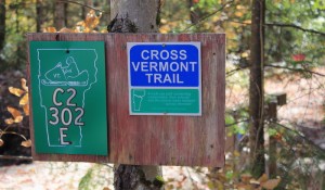
The trail had been an enigma: I wasn’t sure what it was or where it was, until I discovered it by accident. I was riding with friends on gravel roads near Groton State Forest in Marshfield, and there it was: a sign for the Cross Vermont Trail. We followed the route to the next sign and the next one, past stunning scenery: a waterfall, beaver dams and the dramatic cliffs of Marshfield Mountain and Marshfield Pond below.
Back home that evening, I knew I wanted to explore more. I spent some time looking at maps on the Cross Vermont Trail Association website. The 90-mile route travels all the way from Lake Champlain, near Burlington to Wells River, linking a patchwork of local recreation paths, paved and gravel roads, trails, and rail trails (repurposed railroad beds).
Then I pulled out the Vermont Gazeteer: if the Cross Vermont Trail could link together patches of road and trail, so could we. Sitting down with some friends we planned a 53-mile loop through Central Vermont that would take us on a variety of dirt roads and trails from my home in Marshfield into Cabot and, conveniently past the Cabot cheese factory, through Danville and Peacham and back around to Groton.
 From Groton we would hop onto the Cross Vermont Trail for about 20 miles, where it follows an old rail bed for much of the way (with never more than a three percent grad), for an easy pedal back into Plainfield. The goal was to stay all on dirt and Class IV roads, save for the short paved sections that would lead us to cheese samples and dinner at Positive Pie. I could already taste my favorite Hill Farmstead brew.
I woke up on the morning of our ride to a low fog hanging in the valleys. The sun was shining bright behind it and thin wisps of fog blew overhead breaking up momentarily to reveal a magnificent blue sky just waiting to break through. It was lifting and today was going to be good.
With the coffee brewing, I looked at the maps in my Vermont Gazetteer one more time. The route was new to me, and I wasn’t sure about some of the roads, in particular the Class IV roads showing as dashed lines on the map. Would they be passable? Would we be hiking our bikes for miles? The unknown was all part of the adventure. Just then a gleam of sun cut through the fog and through my kitchen window, sending a stripe of sunshine across the map. I took it as a good sign and ripped the pages out of the mapbook, folded them into a Ziploc bag, and stuffed it in my back jersey pocket.
After coffee, around 10 a.m., Tristan, my partner, and our good friend Mike and I hopped on our cyclocross bikes and started on the familiar roads of Marshfield from Hollister Hill to East Hill. As we rode down Ducharme Rd., we passed Birdman, a sculpture studio out in the middle of nowhere where Edmond Menard carves intricate birds from cedar. Outside, Birdman’s colorful sculptures decorated the roadside and we slowed down to take it all in.
From there, we were cruising downhill on more dirt roads past quintessential dairy farms into downtown Cabot. A short stretch of paved Route 215 brought us to the Cabot Cheese, and we took our turns around the samples. We bought maple syrup nippers and tucked them in our jerseys in case a desperate moment later on called for a quick sugary boost.
Onward, we were headed into the biggest climb of the day: four miles and 3,000 feet up Danville Hill. Our rewards were stunning mountain views from Killington to Jay Peak, and a sore knee for me. We pedaled along more miles along Macks Mountain Road through Danville and towards Peacham, passing more dairy farms and a ceramic studio with beautiful earth-toned pieces for sale by the side of the road.
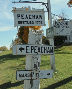 The village of Peacham is like going back in time with a classic village green, white-steepled churches and homes from the 18th century. The farmers’ market was going and a local store had put out cookies and cider for free. We helped ourselves to the treats and took a break for lunch, scoring a few fresh things at the farmers market and snacking on the salami and cheese we had packed.
This was where things were headed deep into the unknown. A Class IV road, called County Road, was to take us from here to Groton, where we would finally pick up the Cross Vermont Trail, which would be mostly car-free. The road started as a beautiful one-laner past some farms and working forests, but soon became a steep, cobble-stone route that was more streambed than road with several sections of hike-a-bike. At the top of what I hoped would be our last steep hike, I could see the upcoming intersection, meaning this stretch was coming to an end.
From there, we pedaled down a dirt road and onto Route 232 and then we were at the Groton trailhead for the Cross Vermont Trail with a friendly kiosk and maps, and plenty of parking for the walkers, cyclists, and explorers traveling this section of trail. From here it was 20 miles of smooth double track pedaling with nary a climb (the grade is never more than 3 percent). It was a chance to ride side-by-side and chat and spin out our legs after a day of tough riding.
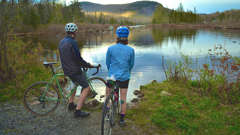
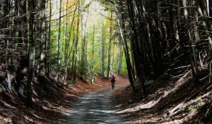 What I hadn’t expected along the rail trail was the scenery: We pedaled past Ricker Pond and its state park lodges. Families were swimming and lounging, and the smell of campfires hung in the air. We pedaled through long stretches of uninterrupted forest, chatting the whole way, and then past more campgrounds (there are five beautiful state park campgrounds in Groton State Forest that are all accessible from the Cross Vermont Trail), and past more lakes and ponds. We came to the stretch of trail I had ridden before, and there I was, again pedaling along with the backdrops of beaver ponds and dams, Marshfield Mountain’s dramatic face, Marshfield Pond, and Bailey Pond.
In Marshfield, at the intersection with Lower Depot Road the Cross Vermont Trail heads back down to Route 2, but we opted to skip the busy section of paved road and stay high on the ridge old logging roads that we knew from previous rides, and then rejoin with the Cross Vermont Trail just a few miles beyond this point.
Back on the Cross Vermont Trail, we pedaled through more long stretches of forest, and reveled in every blissful car-free minute. Then the trail led over a stream and into a grassy field, and we were at a familiar neighborhood swimming spot on the Nasmith Brook. We crossed the river high on a trestle and could see people swimming below. Then we pedaled on, eventually passing the trails leading to Twinfield school and then a park, a small nature preserve, and into downtown Plainfield.
We stopped on the green lawn in front of a church across the street from Positive Pie, just in time for an early dinner. Our legs could go no further and we laid on the grass for a few minutes to stretch. Then, slowly, we gathered ourselves together, locked our bikes to a sign post, and headed inside for beer. We toasted to lives well lived, and ordered up our favorite treats, fried Brussels sprouts and pizza. Then, tired, full and ready for bed, we pedaled the last two miles back home.
Photos by Tristan Von Duntz
Mapping Your Own Trail
The route Sarah Galbraith took covers a portion of the Cross Vermont trail but most of it was gleaned using the Vermont Gazeteer. For the Cross Vermont Trail, maps, guide descriptions, and cue sheets are available at www.crossvermont.org. One of the goals of the organization is to move sections of the trail off high-traffic roads, such as those that run along Routes 100B and 2, and onto quieter car-free paths. CVTA’s Capital Campaign Project aims to raise the funds to construct a massive bridge across the Winooski River in East Montpelier that would allow the trail to run car-free from downtown Montpelier to the village of Plainfield.