The Vermont 5
Some people hike New Hampshire’s 48 4,000-footers, others the 46 in the Adirondacks. These two summited Vermont’s 5 4,000 footers in a day.
STORY AND PHOTOS BY TIM PECK AND DOUGLAS MARTLAND
It’s July 15, and the clock starts momentarily here at the Bucklin Trail parking lot in Mendon, Vermont. In just seconds, it’ll be 8 p.m. and we’ll embark on our adventure; trying to climb all of Vermont’s 4,000-foot mountains in the next 24 hours. Really, it shouldn’t be that hard. After all, there are only five peaks (Killington, Abraham, Ellen, Camels Hump and Mansfield), and our goal leaves us exactly twice as much time as Owen Smith—holder of the fastest known time for the trip—needed in August of 2015 to complete the cumulative 28 miles of hiking, 9,000 feet of elevation gain, and associated driving from peak to peak. So certainly we should be able to do it, right?
Now you’re probably thinking 8 p.m. is a strange time to start hiking. And we totally agree. Since we met as employees in an outdoor store in Massachusetts over a decade ago, we’ve been regularly hiking, climbing and skiing together in the Northeast and beyond and this is definitely one of our latest “starts.” But between family obligations, work schedules, logistics (we’re both from out of state, Doug from Massachusetts and Tim from New Hampshire) and making sure there’s a little time for sleep, fitting this endeavour in was complicated.
It was also something we wanted to make time for. Vermont’s 4,000-footers are among the coolest in the Northeast and hiking them all in 24 hours has been on our bucket list for a while. How did it end up there? We’re not really sure. But if you’ve been hiking for long enough, you know the feeling: once a route idea starts rattling around in your head, at some point you just have to give it a try.
8:32 P.M. Mendon, VT
Thirty-two minutes in and we’re making quick work of the 3.6 miles from the trailhead to Killington’s summit, as the Bucklin Trail’s initial flat-ish portion disappears behind us. Besides discussing the logistics of the trip, we haven’t spoken in a few weeks, and the conversation is relaxed and flowing, but the pace is fast. If we move quickly, we might catch the sunset from Killington’s summit.
9:10 P.M. Cooper’s Cabin
We’re breathing heavily now. The trail is leveling off after climbing steeply toward Cooper’s Cabin. As we draw near, the sights and sounds of backpackers finishing dinner and settling in for the night come into focus. The smell of food and the chattering of fellow hikers is momentarily distracting and cabin life seems a pleasant diversion. But with light fading fast, we push on.
9:33 P.M. Killington Peak
Having negotiated the final quarter-mile (the steepest and rockiest section of the trail), we summit just in time. Although we’ve missed the true sunset, the western sky is still a tapestry of brilliant purples, pinks and reds; colors that offer enough light to let us pull headlamps from our packs. Meanwhile to the east, the sky is transitioning from deep blue to black. To the southwest, a crescent moon, with Venus shining prominently above, straddles the divide, momentarily marking the transformation between day and night.
It’s tempting to linger, and we do for a few minutes. But when darkness envelops the summit, we depart. With one summit complete, we retrace the 3.6 miles to the car, headlamps illuminating the path.
10:13 P.M. Gifford Woods State Park
While Doug and his family spent the day in Vermont, Tim drove straight from work to Killington. Because of that, we’re hastily trying to assemble Tim’s tent by the beam of his headlights. Hopefully, we’ll be done quickly and can get some rest. Regardless, with a 5 a.m. alarm, our stay at Gifford Woods State Park will be a short one.
7:00 A.M. Route 100
Although we’re up before our alarms, driving from the campsite near Killington to Lincoln Gap on Route 100 has taken longer than expected. Before departing the lot, we ensure we have everything we’ll need. We’re returning to a vehicle between hikes, so we each carry only a small, lightweight pack containing just a few select items: water, some snacks, ultralight rain shells, windshirts, super-thin puffies, hats and gloves, and a small first-aid kit.
Since this is the longest independent section of our trip—the 10.5 miles from Lincoln Gap to Mount Abraham, across the Monroe Skyline to Mount Ellen, and down the Jerusalem Trail where Doug’s family will be waiting to shuttle us back to Tim’s car at Lincoln Gap—and it’s forecasted to be hot and humid today, we both decide to pack an additional liter of water.
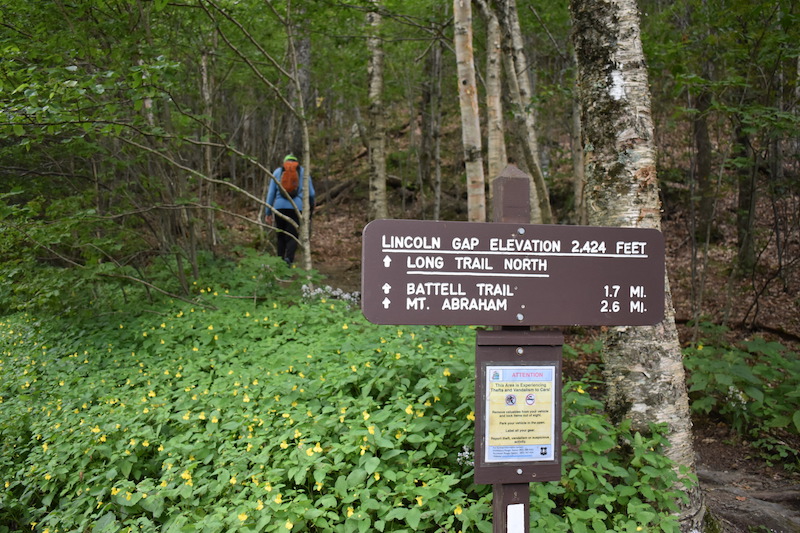
8:11 A.M. Lincoln Gap Trailhead
The easiest and fastest of Vermont’s 4,000-footers, the summit of Abraham is just 2.5 miles away and 1,600 feet above the Long Trail trailhead at Lincoln Gap, making it the the perfect warm up for what’s sure to be a very long day. We’ve made good time up the trail on the first two(ish) miles from Lincoln Gap and just passed the Battell Shelter. The caretaker is stirring, beginning her morning routine. The smell of food—bacon, we think—permeates the air. It would taste so much better than the energy gel “breakfast” we had, but a busy day awaits us. We head up. Another mile ahead is Abraham’s treeless summit. The last bit is a steep climb. But we’ll trade that short challenge for summit number two and the fantastic early morning view that’s sure to be waiting with it.
8:34 A.M. Mt. Abe
Being on the trail early has its privileges. We get the rare satisfaction of having Mount Abraham’s summit to ourselves—the second in a row, thanks to our off-hour climb up Killington. We pause on the summit, shoot a few photos, and eat what, for today at least, passes as a “real” breakfast: a baloney sandwich for Tim and a Clif Bar for Doug. The contrast in the make-up of Tim’s sandwich—the organic bread and Cabot cheese versus the cheap baloney—leaves us laughing at the choices people make.
9:54 A.M. Monroe Skyline
The Monroe Skyline rolls along forever, popping in and out of the woods, occasionally at the top of one of Sugarbush’s ski lifts. With minimal ups and downs, the five-and-a-half mile traverse is the most consistently “easy” terrain we’ll hike today. Since Abraham, we’ve crossed Lincoln Peak (with its great lookout platform) and Nancy Hanks Peak and have seen some amazing wildflower patches. Now we’re approaching Cutts Peak.
10:13 A.M. Mount Ellen
Still on the Long Trail, we arrive at the summit of Mt. Ellen—number 3 of the VT 5—but with no view to speak of, and many more miles before us, we continue traversing along the ridge for almost two more miles before branching off on the Jerusalem Trail, heading downhill to the trailhead where Doug’s family is waiting for us.
11:05 A.M. Jerusalem Trail
Here’s the road at last. We’ve finally finished the Jerusalem Trail, descending for what felt like forever through dense Vermont forest and, as we neared the road, a spiderweb of maple sugaring pipes. Even better, Doug’s family found the trailhead on Jim Dwire Road, a feat that eluded us the first time we did this traverse (but did lead to us getting a nice tour of Bristol). Gear stored in the car and kids peppering us with questions, we make quick work of the drive back to Lincoln Gap. Once back in Tim’s car, the ride north on Vermont 17 and a hodgepodge of country roads to the Burrows Trailhead at Camels Hump is mostly silent as we gobble food and rehydrate. Even though we’ve crossed the halfway point, the heat of the day and a lot of trail time are still ahead of us.
12:30 P.M. Burrows Trail
Right now, we’re stretching our legs—stiff from the 45-minute car ride—on the the rocky, rooty Burrows Trail. Although the trail starts out easy, it gets steep fast as it ascends Vermont’s third-tallest peak (elevation: 4,081 feet) over the course of 2.5 miles. Unfortunately, we just left the car at the Burrows trailhead. Most of the 2,500 feet of elevation gain still stands above us.
We’ve been hiking together in the Northeast for 15 years and have a pretty good collective sense of when it’s time to put the hammer down. Shortly after hitting the trail, somewhere along the wooded corridor of the Burrows Trail, we flip the switch. Heads down, autopilot on, our feet march steadily up the mountain, as we swiftly gobble up the 2.5 miles and roughly 2,300 feet of elevation gain.
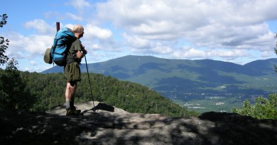
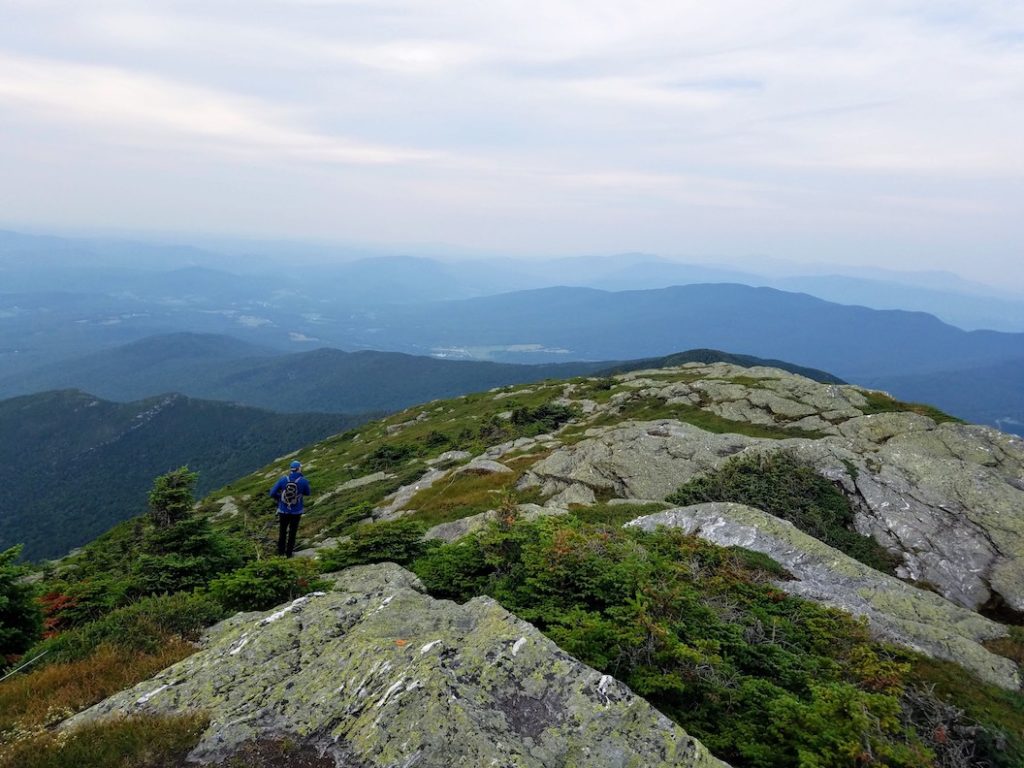
1:37 P.M. Camel’s Hump
Lost in the reverie that is hiking, we unexpectedly stumble into the clearing where the Burrows Trail joins the Long Trail. From here, it’s a short jaunt south on the Long Trail into the alpine zone atop Camels Hump. Between the lichen-covered rocks, the fragile alpine plants, and the 360-degree views, it’s sure to be a highlight of the trip.
With temperatures in the mid-90s and the air thick with humidity, we also beg audibly for a breeze.
Although the breeze disappoints, the view doesn’t. We sit for a moment and take it in. Mountains of green spill out all around us. To the north, we spy the highest of them all: Mt. Mansfield, our final destination. With the end in sight, we wearily begin to retrace our steps the 2.5 miles down the mountain and back to the car.
3:55 P.M. Waterbury
With no traffic, it’s a little over an hour drive from Camels Hump to our final hike of the day: the Long Trail up Mt. Mansfield from Stowe Mountain Resort. However, courtesy of road work, we’re at the mercy of the construction worker holding the Stop/Slow sign. With Ben & Jerry’s just down the road and motivation fading as we sit in the unmoving car, abandoning our plans for a few scoops sounds pretty good. But just as our motivations start shifting, traffic breaks and our thoughts of ice cream are put on hold—at least for a few more hours. A Google search confirms that Ben & Jerry’s is open until 9, leaving us plenty of time to finish hiking and return here before closing.
4:43 P.M. Stowe Mountain Resort
Leaving the parking lot at Stowe Mountain Resort, we follow a newly rerouted section of the Long Trail along wooden bridges and passing beaver ponds before we begin climbing the mountain proper. Once again on the iconic foot path, we breathe a sigh of relief knowing that this time we’re enroute to the day’s last objective: Mansfield’s
summit. The car ride and the how-is-it-still-in-the-mid-90s heat have taken a toll, so much so that covering the Long Trail’s comparatively benign first mile is a massive labor. Despite our tired legs and the brutal heat, this has become a race against the clock, as we have a little more than three hours to cover the 5 miles and almost 3,000 feet of elevation gain and loss to succeed in our goal to climb all of Vermont’s 4,000-footers in 24 hours.
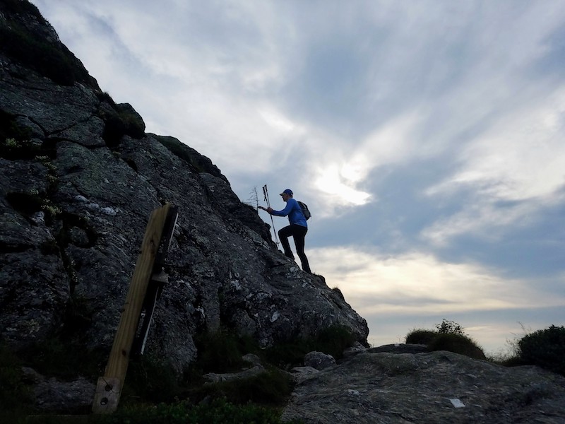
6:15 P.M. Mt. Mansfield Summit
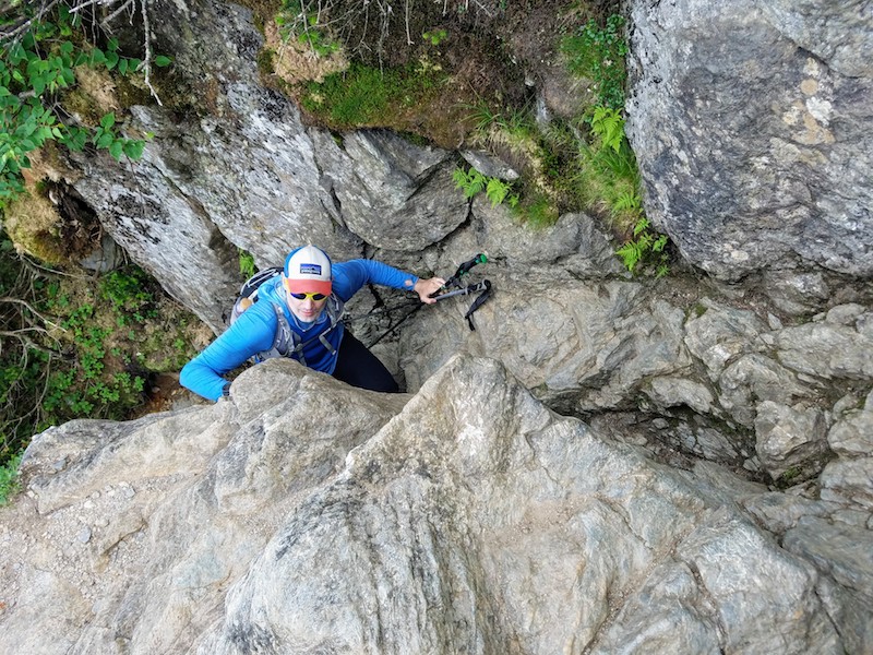
We arrive at the col between two of Mount Mansfield’s prominent features The Chin—the mountain’s true summit—and The Adam’s Apple. Although we are close, the summit still looks far away and the clock continues to tick. Knowing that the most consequential terrain of the day lies ahead, we each have a gel and drink deeply from our bottles before scrambling to the summit.
Standing on the summit we are met with a steady, cool wind for the first time on this trip. In just moments, the refreshing breeze begins to feel cold and we dig windshirts from our packs. Equally refreshing is the realization that it’s all downhill from here. Like most of the summits on this trip, we have this one to ourselves. Before descending, we take a few minutes to finish our remaining water, enjoy the views, and take delight in the fact that we will be back at the cars before 8 p.m., the official end of our day.
7:43 P.M. Long Trail
The descent back down the Long Trail is an uneventful slog. Although we haven’t discussed it, we’ve both been watching the clock and are fully prepared to sprint the remaining distance to the car should it become necessary. Fortunately for our weary legs, the road is in sight and the finish line is just around the bend. In a few minutes, parking lot beers will make everything much better.
8:24 The Road Home
Stuck in traffic again somewhere between Stowe and Waterbury, we’re reflecting on our quixotic adventure. In the last 24 hours, we climbed five 4,000-footers (as well as a few other mountains on the Abraham-Ellen traverse), hiked almost 28 miles, and gained (and lost) about 9,000 feet of elevation. We discovered that summiting the VT 5 in 24 hours is well within reach of the average weekend warrior, and is comparable in difficulty to other classic New England hiking challenges, like the Presidential Traverse—the iconic 22-mile trip across the White Mountains’ Presidential Range. More importantly, though, we had a fantastic day in the mountains and are already thinking about what’s next. Anybody have suggestions?
Featured Photo: On top of Camel’s Hump with one peak to go. The record for doing all 5 of Vermont’s 4000-footers, supported by car is 12 hours, set by Owen Smith. But in 2016, Peter Howe did it by bike in 15 hours, 49 minutes.