5 Great Introductory Rivers to Run
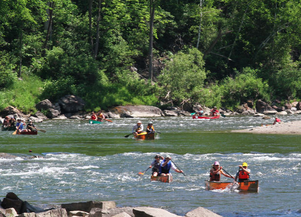
If you want to get a taste of whitewater these introductory stretches of water provide easy access and rapids suitable for less experienced paddlers at the right water level. Before each trip, check for current stream flows at waterdata.usgs.gov, as they can drastically change the difficulty and danger associated with a given route.
For more about how to get into whitewater paddling in Vermont, see “Dropping In.”
Lower Lamoille River from Fairfax Falls to Arrowhead Lake
Distance: 6 miles Hardest Rapid: Class II+/Class III
At high water, this trip becomes more challenging, but from 800 to 2,000 cfs, it is an easy-moderate whitewater trip that’s runnable through the summer and flows through a valley dotted by farms. Put in at the Green Mountain Power access below Fairfax Falls. The final Five Chutes Rapid is Class III in high water and is a popular play spot for kayakers. Take out at the parking area at river right just before the rapid to skip it. Otherwise, take out on the right just before the railroad bridge. lamoilleriverpaddlerstrail.org
The Middle Mad River
Distance: 2 miles Hardest Rapid: Class II
Put in at the gravel yard in the village of Moretown and follow the meandering Mad River through gentle but fun rapids as it runs along Route 100B. Be careful at the low head dam about 2.2 miles into the run. Caution dictates portaging around this feature. Take out at Moretown’s Kenneth Ward Park (Ward Swimming Hole) before the Mad River goes over the Moretown Dam, and enjoy a pleasant swim. americanwhitewater.org/content/River/detail/id/3435/
The West River from Salmon Hole to the Route 100 Bridge
Distance: 3.5 miles Hardest Rapid: Class II
During the twice annual scheduled releases of the Ball Mountain Dam, this stretch of the West River is a great zone for novice and intermediate whitewater boaters. Put in by the Jamaica State Park day use lot. The highlight is a Class II+ rapid called “Ducky Dump” that is short but tricky, with a recovery pool at the bottom. Take out where Route 100 South splits from Route 30. americanwhitewater.org/content/River/
detail/id/2056/
The Lower White River from Sharon to West Hartford
Distance: 7.8 miles Hardest Rapid: II (III)
At warm summertime flows of between 300 and 1,500 cfs, the Lower White River becomes a novice paddler’s playground. Put in at the White River Partnership’s Broad Brook Access site on Broad Brook Road. Paddle through a series of ledge drops, including one rapid that navigates an old dam (this can be avoided with a portage) and Quartermile rapid, a checkered maze of small ledges. Take out at the West Hartford Bridge. whiteriverpartnership.org
Winooski River from Middlesex to Waterbury
Distance: 5 miles Hardest Rapid: I (II)
This stretch of scenic river is an easy midsummer whitewater run when water is low elsewhere. The first rapid, Hugo—named for the fun wave that forms at high flows—is about 200 yards downstream of the canoe access, below the Middlesex dam, with a big eddy below it. Watch for Junkyard Rapids (Class II) after passing under the Route 2 bridge. This is a great place to practice scouting a rapid, or to catch a wave in a playboat. Then it’s smooth, scenic paddling to the Waterbury Recreation field. americanwhitewater.org/content/River/detail/id/3231/
Looking to take a roll or safety clinic or upgrade your gear? Check out these resources across the state.
Featured Photo: Though stretches of whitewater like the New Haven River at the Ledges may be inspiring, you don’t have to paddle the toughest rapids in Vermont to find community and a good time. Photo by Caleb Kenna

