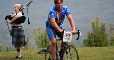
A Great ADK Gravel Grinder
Riding the gravel paths of the Adirondacks can take you back in time.
By Sue Halpern.
Sure, Alaska has the Ididarod—998 miles of snow, dogs and sleepless fat bike riding—but the Adirondacks, well, the Adirondacks has the Ididaride Gravel Grinder.
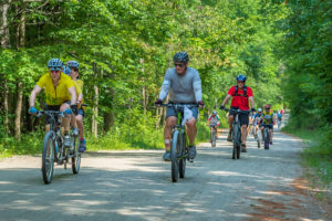
In a typical year, the Ididaride offers a mostly mellow 21-mile cycling roller coaster along the back roads of one of the less-well-traveled corners of the 600- acre Adirondack Park—and a 55-miler for roadies. Held at the end of August, it raises money for the Adirondack Mountain Club.
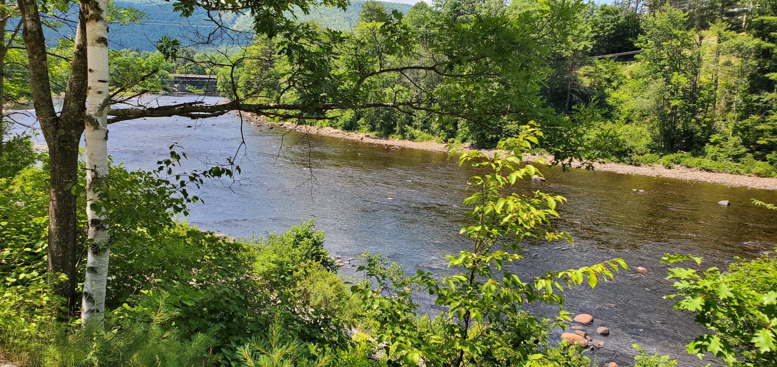
In this atypical year, the club made it a DYI event, encouraging participants to head out on their own at any time during the summer. So, on a day in July, when the temperature approached, and then topped, 90 degrees, I drove to the town of Riparius, on the banks of the Hudson, to begin the ride. Riparius is not where the official loop starts, but I was thinking ahead, to the cool river washing over my hot feet, 21 miles in the future. Near where I parked at Riverside Station, an early 20th century railroad depot, now on the National Register of Historic Places, there is a path that drops down to a perfect riparian perch.
Not long ago, when a tourist train ran from Riverside to the town of North Creek, eight miles away, there was an annual “beat the train” running race along River Road, and it was that route I was following.
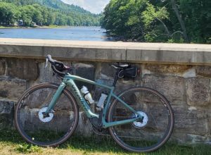
It was an uphill start, with the train tracks and the Hudson rapidly fading from view, and what few houses there were, growing farther and farther apart until there was only deep forest on either side of me. I was on my 11-speed Specialized Turbo Creo, a pedal-assist gravel bike, trusting that its 38 mm tires would be aggressive enough to handle the terrain.
Dry weather had pulled the moisture out of the road, so I was sometimes riding on sand, and it interrupted my forward motion the way a patch of warm snow catches skis on a downhill. (Note to self: Next time, use platform pedals, not clip-ins.)
The bike itself was a dream. Its hydraulic stem dampened most of the road vibration, and even at the lowest level of assistance, it was like having an extra set of legs on the climbs.
This let me concentrate on staying upright as I negotiated ruts and scree that otherwise might have toppled me. A few of the downhills were gnarly—more mountain biking than gravel biking.
But when a gray fox crossed my path, I was reminded that roads like this one are only less-traveled by humans. At times I could hear the river, but as the road narrowed and moved inland, the grouse and squirrels rustling in the underbrush were louder. A white-tailed deer, browsing at the periphery, hardly looked up as I went by.
About five or six miles in—I wasn’t really paying attention—the air was suddenly suffused with pine scent, and soon there were cleared woodlots and a couple of “For Sale” signs. Before long, the train tracks reappeared, rusted and overgrown, and I knew that North Creek wasn’t far away.
The Hudson came into view, skittering over boulders the way I had been bumping along the stones and corduroys of River Road. In the 19th century, North Creek was a center of the tanning trade, curing cowhides shipped from South and Central America with tannin from its then-abundant hemlock trees. Back then, the town was something of a North Country boomtown; the population in 1892, which was just shy of 3,000, is greater than it is today.
The tanneries are long gone, and today North Creek is best known for its train station, where, in 1901, Teddy Roosevelt, who had been hiking in the Adirondacks, took the oath of office after he learned that President McKinley had been shot, and for the Gore Mountain ski area, which towers over the town. (In the 1930s, trains from New York City brought skiers to the town.)
A quick right would have taken me along Main Street, where both Sarah’s Café and Izzy’s Market are rich in home- baked snacks and oversized sandwiches, but I resisted. Instead, I crossed Route 28 and climbed for about a mile on the smooth pavement of Peaceful Valley Road (because I missed a turn that would have returned me to dirt sooner), turning left onto Back to Sodom Road. (Seriously. Peaceful Valley Road used to be called Sodom Road, and because Back to Sodom is a semi-circular road, its name makes a certain amount of sense. Why this neighborhood is called Sodom, and has been since 1795, no one seems to know.)
About a mile down Back to Sodom— about halfway through the ride—as the road followed the curve of a small creek, I discovered an ideal stopping place: a waterfall and swimming hole with smooth, flat rocks for lounging. It was refreshing place to idle before recommencing, pushing up a steady climb punctuated by a few sand traps.
I almost missed the uphill, hairpin turn onto Oven Mountain Lane. After a short steep ascent, and a right turn onto Oven Mountain Road, I was back in the forest, pedaling along a rolling, twisting track that was more up than down. Until it wasn’t and I began a screaming descent picking up so much speed that my bike would have launched into orbit if I hadn’t seen the massive frost heave near the bottom.
Instead, I landed in the hamlet of Johnsburg next to an abandoned mechanic’s shop, its windows shattered and its metal roof crushed in on itself like a crumpled tin can. Like that place, Johnsburg, has seen better days—it once had a diner, a small grocery and a liquor store, none of which survive. But crossing Route 8 (again), and dropping down the chewed-up macadam of South Johnsburg Road, past the oddly palatial house just after the Methodist Church, offered a quick lesson in local history. The house is on land where John Thurman (the eponymous founder of both Johnsburg and Thurman, one town over) lived.
Thurman bought 25,000 acres of this untamed wilderness from the newly- incorporated state of New York in 1788, and then 75,000 more, with the starry- eyed, and mostly misbegotten idea of turning it into a major New World industrial hub. His property, which Thurman called Elm Hill, became home to a sawmill, grist mill and distillery, and nearby, the country’s first calico mill, all gone now.
Millwood Road, just past Elm Hill, hugs Mill Creek, which supplied the power for Thurman’s numerous operations. Narrow and shaded, with easy access to the water, it soon opened to a meadow, green with marsh grass. A well-constructed wooden bridge let me cross the creek, chattering as my tires passed over it. It was an easy glide from there to Washer Hill Road, and an even easier drop back to Route 8.
There’s actual road traffic here, and a four-way intersection with a traffic light, but it was not long before I was done with pavement for good, having turned onto Harrington Road, where I passed a couple of houses, including one where the residents had taken it upon themselves to build a few speed bumps out of dirt and stone.
With four miles to go, the ride had flattened out, following the weave of Mill Creek, which continues on, flowing into the Hudson a few hundred yards past where I turned onto Riverside Station Road.
I was still in the thick of the Adirondack forest, riding under its canopy, shielded from the heat of the day. The first eight miles had been the most challenging, but they schooled me on what to expect for the next 13— soft patches, hardened washboards, and the occasional unexpected boulder poking out of the dirt, but also day lilies, antiphonal woodpeckers, squabbling jays, and second growth hemlocks that have reclaimed their place in this wilderness.
I crested the final hill, felt the gravel segue to beat-up macadam, and coasted toward the terminus. I can’t say what it would have been like to traverse this route in the company of scores of other cyclists, but I’m grateful to have had the opportunity to go it alone, at less than race pace, taking deep breaths—not from exertion, but from exhilaration.
Back roads can take you back in time, and in the Adirondacks that often means back to the natural world before it was a thing to be tamed. I dropped my bike on the grass, and clambered down to the river.
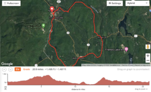
ROUTE FINDING
If you look at a map of the Adirondack Park, you will notice that there do not appear to be many roads. This is true, if by road you mean a paved, efficient conveyance built for cars. On closer inspection you will find a surfeit of dirt tracks and seasonal roads ripe for exploration. BikeAdirondacks.com has a library of gravel rides that is continually updated as riders add more routes. They range from the gorgeous 14-mile round trip Blue Ridge Road to Boreas Ponds, to the killer 82-mile Big Moose loop. The rides are indexed by region, and the maps, which show both the route and the elevation, can be downloaded to your computer or phone. Because the back roads often intersect with paved roads, a gravel bike works best, allowing you to navigate dirt, sand, potholes, frost heaves and, occasionally, nice smooth pavement. Beware: Since this is a wilderness area you are more likely to come across swimming holes than watering holes, so carry whatever you think you’ll need: snacks, water, rain jacket, patch kit, tools—and be prepared for your cell phone not to have reception.