
A Vision for Velomont
Imagine riding from Killington to Morrisville, largely on singletrack
through forests and meadows. The Velomont Trail could be all that, and more.
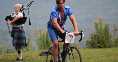
Photos by Brian Mohr/Emberphoto
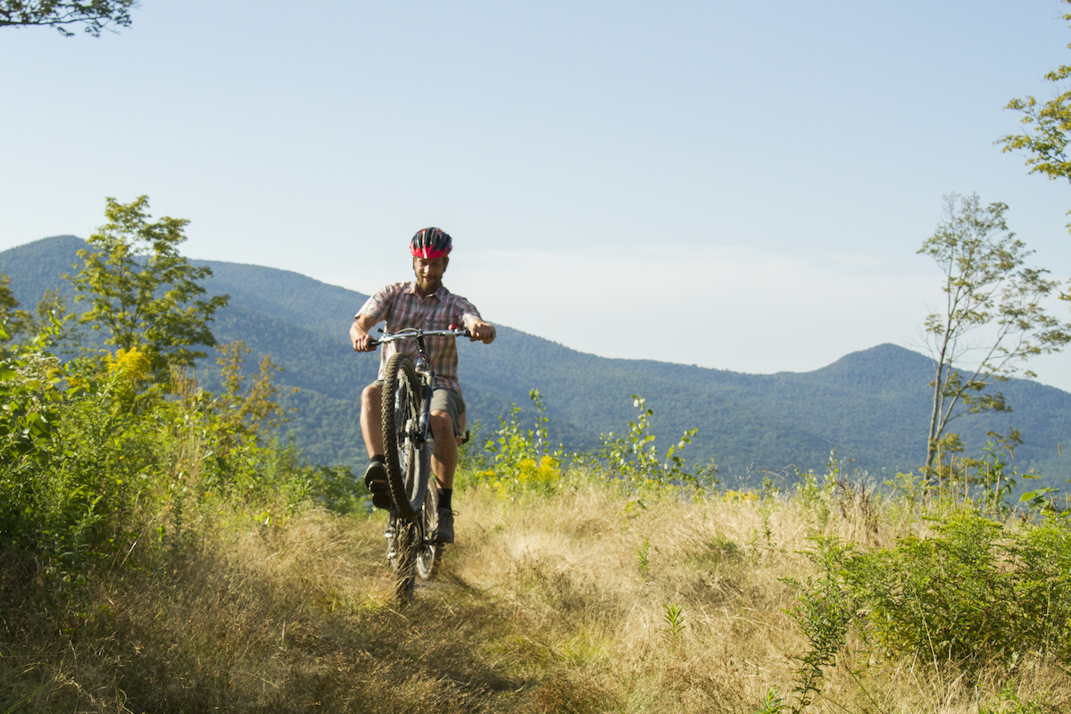
One hot day in September 2015, Dave Lauzon, Ryan Thibault and a couple of friends started their day on Killington Peak. They had no body armor, no full-suspension downhill rigs. Still, they screamed down the mountain, knobby tires kicking out dirt. At the base, they high-fived, got a bite to eat and a beer.
Then they set out on the real ride they’d planned: a 150-mile trek north, largely on singletrack, bikepacking along the way. Camping at huts, staying with friends and checking into an inn, they took their time. They stopped at swimming holes and hit up as much singletrack as they could along the way.
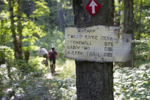
From Killington, they rode a few miles of pavement then cut into an overgrown trail leading steeply up and over a mountain to the Green Mountain Trails in Pittsfield. There, they camped at Shrek’s Cabin, a stone cabin in a clearing at the trail’s summit. The next day, GMT trailmeister Matt Baatz hopped along for what he thought would be a section of the ride. He stayed with them for five days.
The group wove north out of Pittsfield on the Contest Trail (the first sanctioned mountain bike trail in the Green Mountain National Forest), linking sections of logging roads. From Rochester, the next stop was Blueberry Lake.

As Thibault and Lauzon wrote in a chronicle of their ride published on Bikepacker.com: “our goal was to deviate course at every opportunity in order to ride the best singletrack each network offered; Killington, Pittsfield (Green Mountain Trails), Rochester, Blueberry Lake, Mad River Valley, Fayston, Perry Hill, Trapps, Stowe Town Loop, Sterling Valley, Mud City and Cadys Falls were all on our hit list.”
The riders were roughly following what’s known as the XVT route, a loosely mapped trail that runs the length of the state, linking logging roads, sections of the Catamount and other trails and singletrack and minimizing pavement. Five leisurely days later, they ended in Morrisville.
The “XVT” is not an easy way to travel. It takes research to even find the route, and often some bushwhacking to ride it.
In August, 2015, Calvin Decker, a former patroller at Killington, rode the VT from the Massachusetts border to Quebec in a blistering 37 hours. As he wrote in a story for Vermont Sports “300 more miles of dirt roads, muddy paths and singletrack and 33,000 vertical feet of climbing.” Earlier that summer, George Lapierre had ridden it in 54 hours. On a rigid singlespeed.
The Mountain Bikers’ Long Trail
The XVT or Vermont Bikepackers Route, was originally pieced together by bikepackers Dave Blumenthal and Dave Tremblay with help from Tom Stuessy, executive director of the Vermont Mountain Biking Association.
As more and more riders have tackled the route, variations have evolved— spurs running up the western part of the state, an eastern route through the Northeast Kingdom, the “Super8” route. The unsanctioned routes, which occasionally cross private land, have been kept quiet, in the way stashes of winter powder are kept quiet and shared with trusted friends.
Now, thanks to work being done by the Rochester/Randolph Area Sports Trails
Alliance (RASTA), VMBA and the Green Mountain National Forest, plans are underway for an all-access public trail that would officially link up the singletrack networks between Killington and Morrisville—more in the spirit of the tour Lauzon and Thibault did than the hardcore backpacking routes of the XVT.
Like the Long Trail for hikers, the VAST trail for snowmobilers and the Catamount Trail for skiers, the “Velomont” trail, as it has been dubbed, could be, eventually, an end-to-end trail for mountain bikers, horseback riders or randonèe skiers.
As RASTA’s Angus McCusker and Zac Freeman, two of the trails early proponents write on the RASTA website: “We have the opportunity to repeat history, this time with mountain bikes, building awesome state-long singletrack linking some of the best trail systems in New England.”
RJ Thompson of Vermont Huts Association gets excited when he talks about Velomont and the possibilities for huts along the way. “Imagine a year-round hut-to-hut route that you could ski or mountain bike,” he says. Out west, Colorado’s San Juan hut system and network of mountain bike trails, is a model.
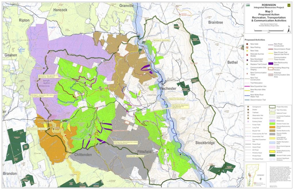
Already, Vermont Huts is aiming to position the first of its huts in the Chittenden Brook campground and it will open this summer, pending approval of the Green Mountain Nation Forest Service’s Robinson Integrated Resource Plan, which is expected to happen this summer.
Thompson is considering other huts in places such as South Pond, in Chittenden, and Sterling Valley, north of Stowe. He’s also working with private landowners who might be interested in hosting huts in Dowsville and Huntington, near trails in the Camel’s Hump State Forest. “We’ve intentionally been looking to site huts at altitudes and locations so they could work for mountain biking, as well as backcountry skiing,” he says.
But the Velomont Trail, McCusker cautions, is still in dream stage. “We’re working with the U.S. Forest Service, with landowners, and with existing trail networks,” said McCusker recently. “It’s a long way off—maybe 10 or 20 years—and there are more than 80 miles of connector trails to build,” he says. The cost estimates to build out the connectors is in the range of 5 to 7 million dollars.
McCusker is careful not to disclose the route until it has been approved by the state, private landowners and the U.S. Forest Service. But on the Vermont Mountain Biking Association website completed sections of trails are mapped and six of the Vermont Mountain Biking Association’s chapters have been working on connecting their networks. “Our goal is to have 70 percent of the Velomont trail be singletrack,” says Stuessy. VMBA membership now comes with an add-on to support building Velomont.
Building Connections
Stuessy and McCusker are cautious when they talk about Velomont, careful not to get too excited or to raise expectations. But both are leaders of organizations that have a track record of getting things done. In the past six years, VMBA chapters have added more than 80 miles of trails around the state, building a network of over 830 miles, largely thanks to the work of volunteers who’ve spent weekends sawing logs and pounding at dirt and roots with pick axes. ‘The chapters are amazing,” says Stuessy. “They are the ones who are doing the work, raising the money and getting things built.”
For now, the groups are focusing on creating Velomont as a way to connect the trail networks that branch off Route 100, from Killington in the south to Morrisville, in the north.
If you browse over the maps on VMBA’s website, networks of spaghetti-like lines of trail networks start to appear. It’s not hard to see what one can imagine as the Velomont emerge.
There, just east of Morristown, are the Cady Falls trails, a short ride up a dirt road puts you on the singletrack of Sterling Valley, trails maintained by the Stowe Trails Partnership (formerly Stowe Mountain Bike Club). From there, head down a bit of pavement (or cut through some trails that are currently on private land). You might connect to the Trapp Family Lodge Trails (trail pass required), then blast down Trapp Hill Road to Cottonbrook Road.
Though Stowe Trails has been busy this winter clearing and re-opening the Cady Hill trails that were devastated by last fall’s tornado-like storm, the organization has plans to continue to improve the connector logging trails between Cottonbrook Road in Stowe and Little River State Park and Thompson envisions a hut, or maybe even two, in the state land there.
Just south, the Waterbury Area Trail Alliance has been building out trails in both the Little River and Perry Hill networks. “One of our missions is to join them with a connector trail and also to connect the town of Waterbury to Little River,” says president Dana Allen. Since WATA formed in 2015, it has grown from 178 members to over 600. “If anyone has any questions about the economic impact that trails can have, just look at the growth numbers of chapters in our state,” says Allen.
From Waterbury, trails would need to be built out to connect via the newly-annexed Dowsville Headwaters section of Camel’s Hump Forest, then to Phen Basin.
Already, this summer the Mad River Riders finished a trail that extends the existing Evolution trail two miles to the top of Tucker Hill. “We want to make it possible to ride from Sugarbush’s base area and trails, all the way into the town of Waitsfield,” says MRR’s John Atkinson, adding that Sugarbush Resort has signed on as a two-year sponsor for the MRRs. This spring, Atkinson’s group also completed a new trail, Amenta’s Way at the Blueberry Lake Trails. Atkinson also envisions a trail from Warren up to Warren Falls, which could also then connect to Stetson Hollow.
“One of the best things about the Velomont trail is it gives a chance to connect all these loops and link towns,” says Atkinson. People want to ride point A to point B, to a destination, not just in loop circles.”
From Blueberry Lake, south to Killington, is where the proposed Velomont trail gets even more interesting. “RASTA has proposed trails on the west side of Granville Gulch,” Atkinson says. But from there south to Pittsfield are a series of existing and proposed trails that RASTA has been working on, in tandem with the Green Mountain National Forest. “We’re actually pretty close to getting trails linked through here,” says Holly Knox, District Recreation Program Manager for the Green Mountain National Forest.
RASTA worked closely with Knox to make the Brandon Gap ski glades happen, the first officially sanctioned backcountry ski glades on national forest land. “If you take a look at the management plan for the Robinson Integrated Resource Project, you can see just where we have trails and what we could extend,” says Knox, her eyes lighting up as she talks.
And yes, there it is, on the map, the Tunnel Brook trail leading west out of Hancock to the Saw Mill Trail, connecting to the dirt roads near Bingo Brook, off Brandon Gap. Then head across Route 73 to Chittenden Brook, where Vermont Huts’ new hut is positioned, or go east along Route 73 past the old CCC camp and eventually connect to the Contest Trail, the GMNF’s first mountain bike trail, which parallels Route 100.
A Plan in the Works.
It’s easy to get carried away looking at the maps, envisioning what could be. Those working on the concept are careful to say the trail will have many iterations as it gets planned out and may take a decade or two build. But groups are working to make it happen and already raising funds to build the trails.
Last summer, the town of Killington received nearly $100,000 from grants from the state’s Department of Forests Parks and Recreation and the U.S. Forest Service and donations from the Killington Mountain Bike Club to help build out trails in the Kent Pond area, a step toward connecting Killington Resort with the town. The ultimate goal: connect Woodstock’s and Killington Mountain Resort’s trails to Kent Pond and on to the Pittsfield Green Mountain Trails. And, as another group proposed in June, perhaps to Rutland’s Pine Hill Park, too.
For now, those who want to ride between these areas have to do the research that Thibault, Lauzon and Decker have done. But one day, not too far off, Velomont may be as popular as the Long Trail.
Pingback: Vermont Sports Magazine, July 2018 - Vermont Sports Magazine
Pingback: The Future of Mountain Biking at Vermont Resorts: Aug 9 Event – VT SKI + RIDE